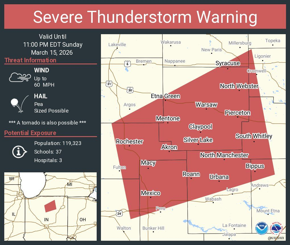
EXPEIRED Severe Thunderstorm Warning 3/15/2026 10:24PM
The National Weather Service in Northern Indiana has issued a SEVERE THUNDERSTORM WARNING FOR:
- Southeastern Elkhart

- Southeastern Elkhart County
- Northern Wabash County
- West Central Noble County
- Western Whitley County
- Northwestern Huntington County
- Central Fulton County
- Kosciusko County
- Northeastern Cass County
- Northern Miami County
- Southeastern Marshall County
until 11:00pm
At 10:24PM Severe Thunderstorms were located along a line extending from 6 Miles North of Rocher to Near Mexico moving Northeast at 65 mph
Hazard….. 60 Mph Wind Gusts
Source: Radar Indicated
Impact: Expect Damage to Roofs, Siding and Trees
Location Impacted Include:
Warsaw, Peru, Rochester, North Manchester, Winona Lake, Syracuse, South Whitley, Milford, Akron, North Webster, Pierceton, Mentone, Mexico, Walnut, Tippecanone, Sliver Lake, Etna Green, Leesburg, Erie and Cromwell
PRECAUTIONARY/PREPARDNESS ACTIONS:
Remain alert for possible tornado! Tornadoes can develop quickly from Severe Thunderstorms. If you spot a tornado go at once into basement or small central room in a sturdy structure. For your protection move to an interior room on the lowest floor of a building
Torando: Possible
Hail Threat: Radar Indiciated
Max Hail Size: <.75 IN
Wind Threat: Radar Indicated
Max Wind Gust 60 MPH