Severe Thunderstorms Possible Thursday 3/26/2026 (Last Updated 3/25/26 10:05PM)
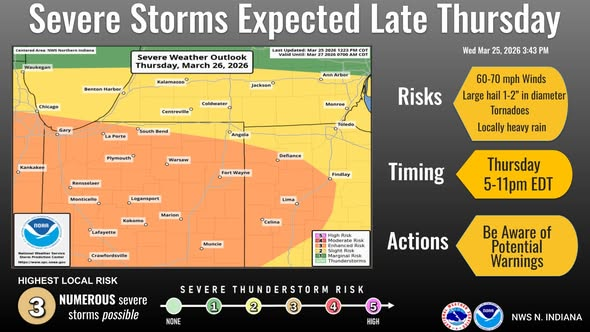
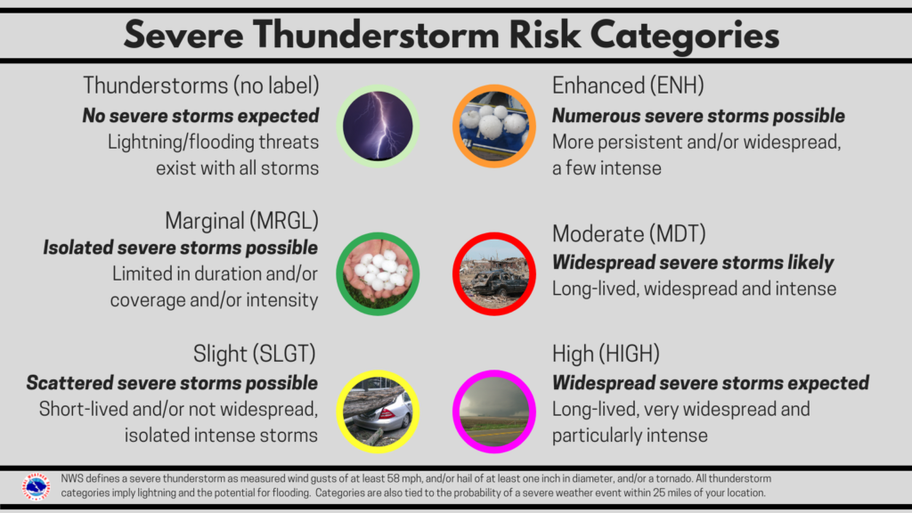
The Storm Prediction Center has placed the Fort Wayne area under an Enhanced Risk for severe storms on Thursday, with the greatest threat between 5 and 11 PM EDT. An Enhanced Risk means numerous severe storms are possible, including some that could be longer-lived and a few that may be intense. Make sure you have multiple ways to receive National Weather Service warnings and seek shelter immediately if one is issued for your location.
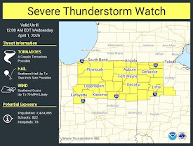
Threats include damaging winds up to 70 mph, large hail up to 2 inches in diameter, isolated tornadoes, and heavy rainfall with potential flooding.
Confidence is medium to high for severe weather developing, but only medium for the timing and extent of each hazard. Storms will probably start off isolated, then merge into a line after 8 PM EDT. The exact timing of this transition is uncertain, which could affect the types of hazards. There’s also some uncertainty about how quickly the cold front will pass through the area, influencing both the severity and how far north the threat reaches. Important updates: Enhanced Risk Introduced; Next scheduled NWS briefing is Thursday, March 26, in the morning.